Before the European settlement of the Auckland isthmus in the 1840s, small Maori settlements existed in the area which later became Point Chevalier, including one at Meola Reef and a fishing settlement at Rangi-mata-rau (later Point Chevalier Beach). The latter was a staging point for shark fishing off Kauri Point on the inner Waitemata Harbour.
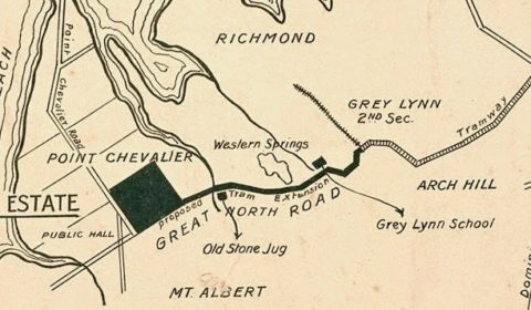
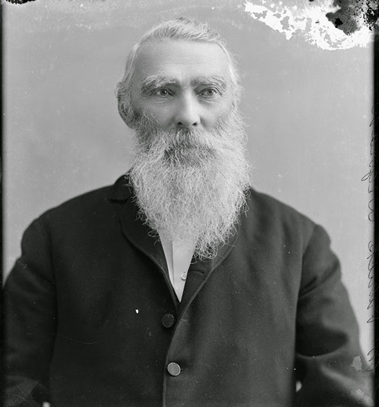
As the city of Auckland grew, Point Chevalier gained strategic importance as it lay on what was then the main land route out of Auckland, the Great North Road. Because of this, a military encampment was located here during the New Zealand Wars of the 1860s. The name ‘Point Chevalier’ comes from Captain George Robert Chevalier (1825 – 1871), a musketry instructor serving in the 65th Regiment, stationed at this camp.
The Point Chevalier area had a largely rural character up until the period between the two World Wars.
The Maori name most associated with Point Chevalier is Rangi-mata-rau (but this, strictly, is the beach area are Harbour View Reserve. The earliest name post-1840 was Point Bunbury, after one of the staff under Governor William Hobson who assisted with gathering signatures on the Treaty of Waitangi. This name, however, appears on only one map, and is forgotten today.
Most of the original surveyed allotments were sold during the mid 1840s under Crown Grant. The earliest development was the establishment of the Low & Motion flour mill at the eastern edge of Western Springs, at Motions Creek, from c.1848.
Around 1858, 127 acres just to the east of the study area, including the Meola Reef area, was designated as a rifle range. The earliest military camp at Pt Chevalier dates from January 1859 at the earliest, most likely on part of the farm owned by Patrick Dignan. From this activity comes Point Chevalier’s name: Ensign George Robert Chevalier legendary target shooting challenge at the camp, which he won around 1859. From that date, “Point Chevalier” became the name of first the camp, and then the district.
A new rifle range was opened up at the end of Target Street in 1867, and was in use until 1871. This was later a site of market gardens, and later still, Selwyn Retirement Village
In 1859, William Edgecumbe completed and opened his Great Northern Hotel, also known as the Old Stone Jug on Great North Road. Early subdivisions began from the 1860s along the peninsula – few were successful or encouraged denser settlement in the area.
From December 1867 until 1874, the area north of Great North Road was part of the Newton Highway District. South of the road was part of Arch Hill Highway District from 1871 until 1874. From that point, the Pt Chevalier Road Board district was formed, including Western Springs, and lasted until amalgamation with Auckland City Council in 1921.
The first store at Pt Chevalier dates from around 1867, tying in with the opening of the Auckland Provincial Lunatic Asylum just across the road that year. In the mid 1870s, the Auckland City Council obtained Motion’s property at Western Springs and established the municipal pumping station for the city’s water supply there.
Pt Chevalier’s Coronation Hall was built in 1911, later to serve from 1938 as the district’s second public library. The current library is on the old site.
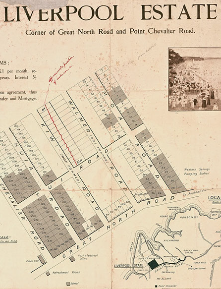
More subdivisions took place in the area from just before World War One, but this time more successful than those of the previous century, due to provision of public transport.
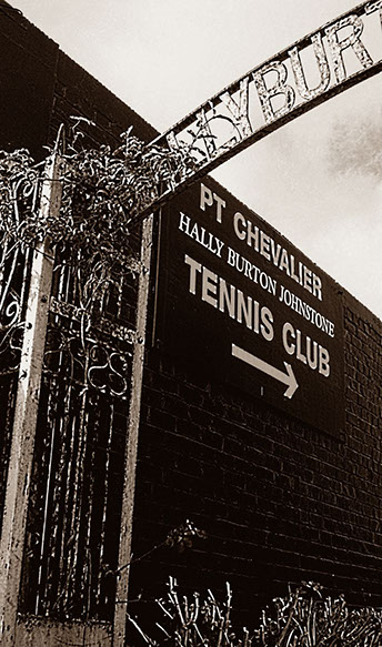
The Anglican Church of the Ascension was built on Dignan Street in 1918. The current Pt Chevalier School on Te Ra Road began as a side school to that at Gladstone in 1924. The first Pt Chevalier police station was established 1925. Thomas Dignan’s house “The Pines” off Dignan Road was gifted by later owner Hallyburton Johnstone in August 1927 along with the remaining surrounds as a recreation ground for bowls, croquet and tennis.
The ASB Bank building dates from the 1930s, and the Ambassador Theatre came to be built c.1929. The Dixieland Cabaret was a drawcard near the end of the Point until it was destroyed by fire early in the 1930s
The main subdivisions of the Pasadena Estate were from 1926 to 1928. Pasadena Intermediate School off Moray Place opened 23 March 1942.